Saturday, December 17, 2016

Log Buildings and the Fenni

In my last foray into Greco-Roman geography, I ended with speculation — that, "[h]ad a globetrotting Greek wandered into the forests of Finland, perhaps he . . . would have returned with reports of 'houses made from trees.'" Whether or not any Greeks (traders or otherwise) possessed knowledge of the lands which today comprise Scandinavia is an open question. In the fourth century BC, Pytheas explored portions of northern Europe (including the British Isles and Baltic coast); alas, none of his writing survives, and his precise route will forever remain a mystery. The Romans, though, certainly could claim an awareness, dim though it may have been, of today's Scandinavia.

About AD 98, slightly more than a century after Strabo wrote his Geographica, historian Publius Cornelius Tacitus published Germania, one of the classical world's best-known ethnographic works. Germania's final chapter covers tribes living to the Germans' northeast — the Peucini, Veneti, and Fenni. This last group (whose name bears an obvious similarity to the exonym "Finn"), Tacitus considers uniquely barbaric. His (brief) description may be the earliest account of Uralic (1) construction methods:
The Fenni are strangely beast-like and squalidly poor; neither arms nor homes have they; their food is herbs, their clothing skins, their bed the earth. . . . The little children have no shelter from wild beasts and storms but a covering of interlaced boughs. Such are the homes of the young, such the resting place of the old. (2)
At a glance, the text seems to support my contention. But, as usual, the Latin is too vague to reveal much about its subject. The relevant line, "ramorum nexu contegantur," could be translated as "a covering of interlaced boughs," but it might also mean "a roof of connected branches" or "a shelter of fastened twigs." Then again, had Tacitus intended to describe log houses, he surely would've employed truncus or trabes, the two Latin words often applied to trunks and timbers.

It's likely, then, that the Finns adopted log construction well after the first and second centuries AD. But who (if anyone) introduced the practice to them? When did the shift from branch hovels to log houses occur? Alas, I can't say. No doubt, the westernmost Uralic-speaking populations interacted with southern Scandinavia's Germanic peoples, who preferred to build timber long-houses (a practice which survived into the Viking Age). The pastoral Sami constructed tents and pole (or earthen) huts — goahti — into the twentieth century. In some ways, these habitations resemble the "covering of interlaced boughs" described by Tacitus.

A Sami family outside their goahti. Photo, 1870s, from the Galerie Bassenge collection; taken from Wikipedia.

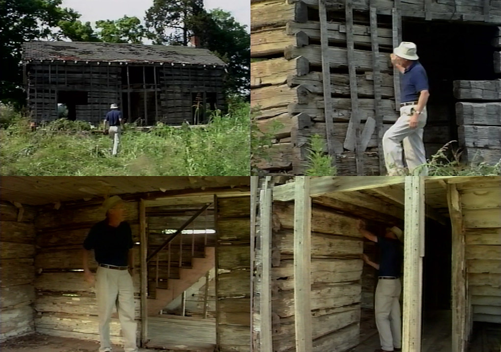
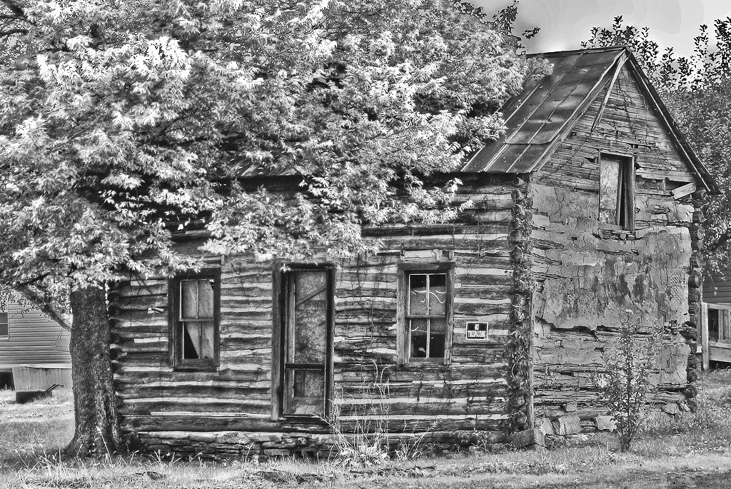
Whatever its origin, log architecture had, by the early modern period, become entrenched in Scandinavia and northwestern Russia. Log dwellings, storehouses, barns, and (especially) saunas dotted the Finnish landscape, and peculiarities of construction acquired distinctive names — hammasnurkka, lukko, and whatnot. At Helsinki's Seurasaari Museum, 87 buildings, the majority log, testify to the popularity of timber construction.

The Niemelä stable, now housed at the Seurasaari Museum. Photo by Jani Patokallio, 2009, from Wikimedia Commons.

In the seventeenth century, Swedes, Norwegians, and Finns brought their architectural traditions to North America, and thus (in conjunction with the Germans) engendered the practice which defined frontier architecture in the United States.

1) I've assumed, of course, that Tacitus's Fenni were, in fact, the ancestors of today's Finns, Estonians, Livonians, Karelians, Ingrians, and Vepsians. But such an identification is a matter of controversy.

2) From the Church, Brodribb, and Cerrato translation (1942); transcribed by Perseus.

Thursday, November 17, 2016

Strabo: Lost in Translation

A few months ago, I sought an answer to the perennial question, "Who built the first log buildings?" I managed to overlook an equally interesting (and no less answerable) inquiry: "What's the earliest mention of log buildings?" Most literature about the subject cites Vitruvius's De Architectura, written during the Augustan age (27 BC – AD 14), as antiquity's first description of log construction. And indeed, as a description — an intricate verbal account — De Architectura dominates. But there exist earlier, shorter texts which also mention log buildings, albeit in veiled verbiage. Foremost among these, and nearly contemporary with De Architectura, is Strabo's Geographica, first published in 7 BC.

When, in March, I combed Geographica for references to log buildings, I used the H.L. Jones translation accessible via LacusCurtius. One passage struck me:
Now all these peoples who live in the mountains are utterly savage, but the Heptacometae are worse than the rest. Some also live in trees or turrets; and it was on this account that the ancients called them 'Mosynoeci,' the turrets being called 'mosyni.' (1)
Interesting though treehouses may be, I dismissed the extract as merely tangential. After all, living atop a tree is quite different from living in a dwelling cobbled together from the trunks of trees. At the time, I scarcely noticed the word "turrets."

Last week, I found myself browsing a different translation of Geographica:
All the inhabitants of these mountains are quite savage, but the Heptacometae are more so than all the others. Some of them live among trees, or in small towers, whence the ancients called them Mosynoeci, because the towers were called mosynes. (2)
Compare this version with the pertinent passage from Vitruvius's De Architectura:
Among the Colchians in Pontus, where there are forests in plenty, they lay down entire trees flat on the ground to the right and the left, leaving between them a space to suit the length of the trees, and then place above these another pair of trees, resting on the ends of the former and at right angles with them. These four trees enclose the space for the dwelling. Then upon these they place sticks of timber, one after the other on the four sides, crossing each other at the angles, and so, proceeding with their walls of trees laid perpendicularly above the lowest, they build up high towers. (3)
Eureka! Strabo's Heptacometae dwell in "small towers"; Vitruvius's Colchians inhabit "high towers." High or low, towers are towers, and I've no doubt that Strabo and Vitruvius describe the same ethnic group, and thus the same building tradition. (Indeed, Perseus translates mossunōn as "wooden houses.")

The Mosynoeci lived along the rugged, forested Black Sea coast, in modern Turkey and Georgia. An 1890 issue of The Athenæum identifies "the people to the south of Kerason [now Giresun]" as "the representatives of Xenophon's Mosynœci," who, at the time, "still [lived] in lofty wooden towers as in the days of the Greek historian." These "lofty towers," it seems, have all but disappeared from Giresun Province; modern masonry buildings (and the odd half-timbered home) now dominate the region. Still, I managed to locate this image. (Perhaps, if I spoke Turkish, I could discover more.)

In Georgia, timber construction is rarer, but distinctively towering dwellings continue to exist in the country's Caucasian foothills, particularly in Svan-speaking Svaneti. Defensive towers dotted the regional capital of Mestia until the late 19th century, and similar structures stand in Ushguli and elsewhere. The Laz, who live in Georgia and Turkey, may, in fact, be related to the Heptacometae — the two communities' boundaries are almost identical.

Buildings in Ushguli, Georgia. Image by Florian Pinel, 2010, from Wikimedia Commons.

Obviously, the tradition described by Strabo, Vitruvius, and Xenophon developed independently of the Scandinavian and Eastern European conventions to which we Americans owe our log buildings. But who knows? Had a globetrotting Greek wandered into the forests of Finland, perhaps he, too, would have returned with reports of "houses made from trees."

- - - - - - - - - - - - - - - - - - - - - - - - - - - - - - - - - - - - - - - - - - - - - - - - - - - - - - - - - - - -

For thoroughness's sake, I thought I'd attempt to "translate" the passage from Geographica. Here's the Greek (transliterated, of course):
Eisi d' hapantes men hoi oreioi toutōn agrioi teleōs, huperbeblēntai de tous allous hoi Heptakōmētai: tines de kai epi dendresin ē purgiois oikousi, dio kai Mosunoikous ekaloun hoi palaioi, tōn purgōn mossunōn legomenōn. (4)
And, a crude and literal translation:
They are but all indeed the Oreioi of these savages perfectly, they throw over but the following another Heptakometai. [?] but and on trees or towers they inhabit, wherefore and Mosunoikous called the old (people), because towers wooden houses were called.
Perseus gives no proper definition for "Oreioi," but the term seems to describe a long-defunct Cretan city (between modern Anidri and Prodromi). A few resources link the name with "people of the mountains"; perhaps Strabo used the word equivocally or metaphorically, to describe non-Cretan mountain-dwellers. Another phrase — "epi dendresin" — is a more perplexing matter. Assuming Perseus's dictionary is accurate, the preposition "epi" can mean both "on" and "among," and an accurate translation requires knowledge of the context.

I'll end with a more polished interpretation of the above translation:
Indeed, the mountain people are all perfectly savage, but the Heptakometai surpass ["throw over"] the others. They live on trees or towers, wherefore the people of great age called them 'Mosuoikous,' because the towers were called 'mossunōn' [literally "wooden houses"].
1) From H.L. Jones's translation (1917–1932); transcribed by Bill Thayer.
2) From W. Falconer's translation (1903); transcribed by Robert Bedrosian.
3) From Morris Morgan's translation (1914); hosted by Project Gutenberg.
4) From A. Meineke's Greek edition (1877); transliterated by Tufts University's ever-useful Perseus Digital Library.

Monday, August 15, 2016

Charles Dickens and the Siegfried Tavern

A mile or two north of Delaware, Ohio, stands a weatherbeaten frame building, vacant since 1985, and bearing the usual marks of protracted habitation — additions, alterations, and augmented apertures. It faces busy US Highway 23, which approximates the route of an early road connecting Columbus and Sandusky. The structure's situation betrays its purpose; it served as a tavern (or inn), operated by Jacob Siegfried (1788–1846), a Pennsylvanian, between 1835 and — I presume — 1846.

Siegfried's tavern in 2008. (Yes, this photo is terrible; but then, a person trapped in a moving vehicle cannot expect compositional brilliance!)

And, Siegfried's tavern before its abandonment. Photo by George Cryder (?), 1969, from the Delaware County Historical Society collection.

Affixed to the building is a metal plaque, rendered unreadable (during summer months, at least) by unkempt bushes. In my many years of passing the tavern, I could decipher only one word — "tavern" itself. Imagine my surprise, then, when I browsed the Delaware County Historical Society's slide collection and found this:

The plaque. Image by George Cryder (?), 1969, from the Delaware County Historical Society collection.

At first, I accepted the claim with delight. I'd long known about Dickens's 1842 excursion to America, recounted, with invaluable cynicism (1), in American Notes for General Circulation. But, after a moment's thought, I felt a twinge of uncertainty. Though I'd read (and reread) the portion of American Notes covering the Ohio leg of Dickens's journey, I could recall no mention of Delaware.

In the fourteenth chapter, Dickens describes his sole jaunt through Ohio's interior (2):
There being no stage-coach next day, upon the road we wished to take, I hired 'an extra,' at a reasonable charge to carry us [from Columbus] to Tiffin; a small town from whence there is a railroad to Sandusky. This extra was an ordinary four-horse stage-coach, such as I have described, changing horses and drivers, as the stage-coach would, but was exclusively our own for the journey. To ensure our having horses at the proper stations, and being incommoded by no strangers, the proprietors sent an agent on the box, who was to accompany us the whole way through; and thus attended, and bearing with us, besides, a hamper full of savoury cold meats, and fruit, and wine, we started off again in high spirits, at half-past six o’clock next morning, very much delighted to be by ourselves, and disposed to enjoy even the roughest journey. 
We alighted in a pleasant wood towards the middle of the day, dined on a fallen tree, and leaving our best fragments with a cottager, and our worst with the pigs . . . we went forward again, gaily. (3)
As I feared, not so much as a mention of inns, taverns, or Delaware. (I doubt even Dickens, contemptuous of America though he was, would dare to call Siegfried a "cottager.") In the following pages, Dickens describes only one stop between Columbus and Tiffin — Upper Sandusky, which lies well north of Delaware. If Dickens hired an "extra" for the sake of "being incommoded by no strangers," and dined (while sitting on a fallen tree) from his coach's supply of "savoury cold meats, and fruit, and wine," why would he stop at Siegfried's tavern? Why inconvenience himself with the company of strangers? And why avoid writing about the sojourn?

Dickens's diary provides few answers (though, unlike American Notes, it does mention that his coach changed horses several times). A folder labeled "Siegfried Tavern" — held by the Delaware County Historical Society — contains property research and biographical information about the Siegfried family, but barely mentions Dickens's supposed stay. The 1842 copies of Delaware newspapers seem to be lost.

The plaque's claim, then, is neither provable nor falsifiable. The weight of evidence may lie on the side of doubt, but mere weight is scarcely proof. I've no choice but to speculate.

Perhaps the story is merely hearsay — a local legend repeated by innumerable Herodotuses, and having no more credibility than the 6.2 x 10^14 similar tales about George Washington, Andrew Jackson, and Abraham Lincoln. Perhaps "Dickens passed this tavern" mutated, as verbal accounts are wont to do, into "Dickens stopped here." Or, perhaps, Dickens gave a hearty wave from his coach; Siegfried noticed and passed the impression to his descendants, in whom it transformed into today's story. Or Dickens indeed paused at Siegfried's tavern, albeit briefly, and simply for a change of horses or a bit of leg-stretching.

1) The best nineteenth-century descriptions of America tend to be those given by foreigners.
2) Though Dickens twice visited Cincinnati, he ventured into the state proper only once.
3) American Notes for General Circulation, Volume II (1842), 133–134.

Monday, June 27, 2016

The John Moomaw House

I've devoted a few posts to Ross County buildings, and I could pen a thousand more. Among the most charming (though scarcely the grandest) of these structures was a Paint Township farmhouse, reportedly erected by one John Moomaw.

John Moomaw's residence (with requisite leaning chimney). Photo by Mrs. A.W. Geissinger or Mrs. D.N. McBride (?), from Historic Landmarks in Ohio: Volume II, compiled by several chapters of the United States Daughters of 1812 in 1953. Scanned by Columbus Memory.

Moomaw's abode stood on sloping land in the valley of Upper Twin Creek, due west of the Paint Township-Twin Township border. To the south, beyond Farrell Hill (home to a delightful sandstone cottage), lies the verdant Paint Valley, site of Ross County's earliest settlement. Though Moomaw's farm — which, in 1860, occupied 210 acres — contained plenty of arable land, little remains cultivated; the tract has, by and large, reverted to scrubby grassland and second-growth forest.

The Moomaw family appeared in America between 1731 and 1732, with the arrival of Jacob and Leonhard Mumma. (Many descendants anglicized their names; this page mentions "at least 18 different ways to spell the surname.") Whether the Ross County branch could trace their descent from Jacob or Leonhard, alas, is difficult to determine. A 1937 Scioto Gazette article describes John Moomaw as an "enterprizing [sic] German settler" and member of a German Baptist congregation.

Moomaw, apparently, relocated from Virginia (1) about 1812 and held several offices in Paint Township's fledgling government — in 1813, he worked as an overseer of the poor; and, in 1816, he served as fence-viewer. According to local legend, Moomaw's bank barn — a double-pen log structure — hosted German Baptist ("Dunkard") meetings.

The precise history of the Moomaw residence is difficult to determine. Geissinger and McBride, in Historic Landmarks of Ohio: Volume II, place its construction within the second decade of the nineteenth century:
The date of the house has not been determined, but certain architectural features lead us to believe that it is within the 1812 period.
Rex Hagerling, by contrast, gives the date 1838, presumably gleaned from Ross County tax records. (2) Kevin Coleman writes that "[the Moomaw home] was built about 1820" and classifies the structure as "[having] genetic similarities with the Grenier form." (The "grenier" house, as Coleman defines it, is marked by "[a] symmetrical gabled roof around the loft [which] projects forward, creating an incised or cut-in porch which appears to be carved out of the body of the house instead of being added on." Apparently, the geographer Allen Noble identified this building-type in 1984.)

Indeed, the two-story inset porch — a distinctly Germanic trait — is (or was) the Moomaw home's outstanding feature. This porch; along with the massive sandstone (?) chimney, basement kitchen, exterior staircase, and bizarre window configuration; placed the John Moomaw House among Ross County's finest rural buildings. Its demolition (circa 2000), then, can best be described as "calamitous."

The Moomaw residence after its abandonment. Image by Rex Hagerling, May 1978, from an Ohio Historic Inventory form.

The Ross County Historical Society's collection contains other photos of the Moomaw home.

1) County histories also mention a Henry Moomaw (1791–1871), born in Virginia, who, like John, moved to Paint Township during the War of 1812. Henry's farm existed a few miles west of John's, near the Upper Twin Road-Fordyce Road intersection. No doubt, Henry and John were related.

2) In 1978, Hagerling finished an Ohio Historic Inventory form (ROS-262-11) describing Moomaw's house. In the "Sources of Information" section, he cites "Auditor's Tax Duplicates: 1836, 1837, 1838," and "Ross County Deed Records."

Tuesday, May 24, 2016

Ohio's Roads

Ohio's earliest rural inhabitants, with a few exceptions, practiced subsistence agriculture, and thus needed no refined road network. Scattered trails, passable by foot, horse, or ox-cart, sufficed. These rudimentary roads — exemplified, perhaps, by Zane's Trace — often supplanted Native American byways or deer trails and followed irregular paths. Others; blazed by the U.S. military, established by state decree, or formed by private companies as toll roads; proceeded linearly. In the Congress Lands, thoroughfares often (though not invariably) follow section lines. In the Virginia Military District, the routes seem, in some cases, truly arbitrary. (See, for instance, Greene County's serpentine State Route 72.)

By mid-century, Ohio's counties — or, at least, its well-populated counties — had largely acquired the ample road systems which survive today. (The frequency with which Greek Revival-era dwellings — even those fronting minor thoroughfares — align with roads is evidence of this.)

Inter-County Highway 124 (now State Route 28), a superlative dirt road. Photo from the ODOT archives. The background home is extant.

Until the twentieth century, the Ohio traveler could expect little in the way of comfort. Indeed, a few wealthier counties had, in the preceding century, gravelled or macadamized their roads, but the balance of the state's routes were, by all accounts, veritable styes. In American Notes, Charles Dickens (yes, that Charles Dickens) quips about an 1842 stagecoach ride from Columbus to Sandusky:
It was well for us, that we were in this humour, for the road we went over that day, was certainly enough to have shaken tempers that were not resolutely at Set Fair, down to some inches below Stormy. At one time we were all flung together in a heap at the bottom of the coach, and at another we were crushing our heads against the roof. Now, one side was down deep in the mire, and we were holding on to the other. Now, the coach was lying on the tails of the two wheelers; and now it was rearing up in the air, in a frantic state, with all four horses standing on the top of an insurmountable eminence, looking coolly back at it . . . (1)
Earth-surfaced (i.e., dirt) roads in Ohio, 1915. Data sourced from Names and Numbers of Inter-County Highways and Main Market Routes, and Highway Statistics of Each County, published by the Ohio Highway Department. The darker the county's coloring, the greater its percentage of dirt roads. (Belmont County is clearly an anomaly.)

Navigational Nomenclature

In the nineteenth and early twentieth centuries, the state's county- and township-maintained routes lacked formal names. Open any Victorian-era property atlas, or glance at any prewar county highway map: the local roads are bound to be anonymous. Only after World War II, I suspect, did township and county governments bother to name their vast road networks. (More than likely, this mass-christening coincided with the widespread paving of minor thoroughfares, which had hitherto been largely earth-surfaced.)

A (rather crude) typology of Ohio road name etymologies. The colors designate each county's predominant method of thoroughfare-labeling. A few eastern Ohio counties assign names to only major roads; hence, in Perry County, Wilson Road (County Road 35) intersects Township Road 46, and so on.

Many of Ohio's rural roads bear "connective" names designating the communities which lie at their termini, or else describe the property owners whose tracts sat at their ends. Rosedale-Plain City Road, in northern Madison County, joins unincorporated Rosedale and more metropolitan Plain City, naturally. To the south, Pancake-Selsor Road honors members of the Pancake and Selsor families, prominent in southern Madison County. Rarely do given names appear in road labels. Adams County contains a few exceptions: Starley Gustin Road (which traverses fertile bottomland bordering Ohio Brush Creek), Ira Gustin Road (in Bratton Township), and George C. Biely Road, among others. Many more road names are sourced from natural features, as the repetition of "Hollow," "Valley," and "Run" — in Ohio's Appalachian counties — attests.

All Ohio counties assign numbers to their thoroughfares, but a few (clustered mostly in the state's northwestern quadrant) lack true, or nominal, titles. Williams County, bordering Indiana and Michigan, uses a hybrid numeric-alphabetic system, with its north-to-south-running routes receiving a number (1 through 24), and its east-to-west-traveling roads receiving a letter (A through S). The many routes that deviate by splitting sections combine letters and numbers. Thus, near Montpelier is County Road K-50 (a longitudinal byway situated equidistant from County Road K and County Road L). Logan County's numbering, on the other hand, appears to be inexplicable.

Carroll County's traffic engineers seemingly selected its roads' names by flinging darts at a board or, perhaps, choosing dictionary entries at random. Bacon Road begins at Arrow Road; intersects Glacier, Glory, Jasmine, Buck, Gallo, Fisherman, and Trump; and terminates at a state highway. Elsewhere, Aurora meets Apollo, and Nassau encounters Nature. Confusingly, Lemon Road lies a few miles distant from Lumen Road. Andora Road commemorates — in misspelled form — the tiny Pyrenean nation of Andorra (or Andora, Italy), while Ming Road may memorialize the long-lived Chinese dynasty.

Other oddities surely exist, scattered across Ohio's 44,825 square miles.

1) American Notes for General Circulation, Volume II (1842), 162.

Tuesday, May 17, 2016

Warren County: A Pulchritudinous Place (Part I)

Warren County's political subdivisions. Map plucked from Wikipedia.

If Ross County is a candy store, Warren County may be the ice cream parlor which occupies the adjoining storefront. Like Ross, Warren comprises some of Ohio's earliest-settled lands, straddles a major north-to-south-running river (in its case, the Little Miami), and occupies a surveying boundary zone. The Little Miami River splits the county, roughly, into two regions: the Virginia Military District (east) and Symmes — or Miami — Purchase (west). A few sections of Congress Lands exist in Franklin Township, at the county's northwestern corner, where the Great Miami River skirts the city of Franklin. Warren County's terrain is, as Howe noted, "gently undulating" (1), though broken by the valleys of Clear Creek, Caesar's Creek, Todd's Fork, and — of course — the Little Miami River.

Warren County's first permanent residents arrived in the 1790s. In November 1795, one William Bedle, a New Jerseyan, purchased Section 28 of modern Turtle Creek Township, where he erected a fortified log house, thereafter known as "Bedle's Station." (This home stood due south of Union Village.) Concurrently, a party of Marylanders — led by William Mounts (1762 – ca. 1808) — selected a spot on the Little Miami River's south bank, and built "Mounts' Station," a collection of log dwellings arranged in such a fashion as to dissuade attack. In 1796, less than a year later, surveyors platted Deerfield (now South Lebanon), Franklin, and Waynesville. By 1803, when it was cleaved from Hamilton, Warren accommodated 854 adult males (2); and, by 1810, nearly 10,000 souls called the county home. The Irish writer Thomas Ashe visited (or claimed to have visited) Warren County in August 1806 and described Lebanon (and its environs) thusly:
The remaining fifteen miles to Lebanon [from the Hamilton County border] were nearly the best I ever viewed, and settled considerably for so new a country. The farms were numerous, well improved, and the houses and barns on them built with great care and industry. 
Lebanon contains about two hundred inhabitants, dwelling in about forty neat log and frame houses. A place of worship and school-house are also erected, and the town in every respect bids fair to prosper and encrease with unprecedented success. Seated in the midst of the finest tract of land in the world, and that tract already thickly settled by a hardy and industrious people, it cannot fail to succeed[.] . . . The inhabitants, though few, are composed of several nations, who unite in forming a character of a laborious and religious cast. Their industry is manifest in the extensive improvements and comfortable abodes; all effected within the space of five years[.] (3)
Hyperbole notwithstanding, Ashe's anecdote is accurate enough. In the nineteenth century's opening decades, Warren County far outpaced its northern and eastern neighbors in prosperity. Yes, portions of Harlan and Washington townships — those marked by level, ill-drained, silty Illinoian till — remained little-populated until mid-century, but the county, in toto, enjoyed a prosperous existence.

I'll end my bloviating here, and save a discussion of Warren County's architecture (and regional history) for the next post.

1) Henry Howe, Historical Collections of Ohio, Volume I (1889), 740.

2) This estimate, provided by Beers' 1882 History of Warren County, Ohio, is no doubt inaccurate, and includes residents of Clinton County's western half, which, until 1810, remained within Warren County.

3) Travels in America Performed in 1806, Volume II (1808), 209–211.

Saturday, May 7, 2016

Whimsy and Architecture

First, I should define "whimsy":
whimsy : a playful or amusing quality : a sense of humor or playfulness (1)
Now, I'll let Samuel Johnson and Webster's Collegiate Dictionary define "whimsy":
Whi'msey. n.s. [Only another form of the word whim.] A freak; a caprice; an odd fancy; a whim. (2) 
whim'sey, whim'sy (hwīm'zī), n.; pl. . . . A whim; freak; caprice. (3)
Two (or one-and-a-half) definitions separated by 161 years, yet scarcely a change between them. Only during the twentieth century, it seems, did "whimsy" gain its now-standard meaning as a species of humor. For Johnson and the Webster's editors (who seem simply to have borrowed Johnson's definition), absurdity alone constituted whimsy. Indeed, a tragedy could be whimsical, so long as that tragedy involved the inexplicable. Thus, the nineteenth-century man might stumble into whimsy in a way we now cannot (whimsy having since become a form of comedy). Comedy — the art of the absurd — presupposes intention; the accidentally absurd is merely absurd. We may laugh at it, but we needn't dub it comedy.

I'm justified, then, in calling particular structures "whimsical," because I employ the term in its original sense. Plenty of bizarre, fanciful, and arbitrarily designed buildings dot the American countryside. The carpenters who erected these oddities didn't intend to produce humorous works, of course. But they deviated from convention, and they thereby cursed their creations to notoriety.

In Hillsdale, Michigan, stands a frame house adorned with ample Classical Revival ornamentation: cornice brackets, dentils, an attic lunette, two tripartite windows (one Palladian in form), and a grand trabeated entrance. That the dwelling draws inspiration from classical modes is not odd; other Hillsdale homes (such as Frederick Stock's) do, too. Rather, its peculiarity lies in its proportions. The humble "upright-and-wing" form underlying the ornamentation is hardly fitting for neoclassical grandeur. In no way is the result unattractive, but it does tempt passersby to chuckle.

Classical Revival cottage, circa 1900; Hillsdale, Michigan.

The spoked brackets embellishing the Abram Fisk House — which stands near Coldwater, Michigan, about half an hour west of Hillsdale — resemble either flower petals, wagon wheels, or fan blades. (Architectural Rorschach tests are always a delight.)

Abram Fisk House (NRHP-listed), circa 1863; Coldwater Township, Branch County, Michigan.

An Italianate house — nay, mansion — in South Charleston, Ohio, features lintels incised with snowflakes. (How apropos, then, that I happened to photograph it during the winter.)

John Rankin House, 1885; South Charleston, Ohio.

One Bartlow Township, Henry County barn — known locally as the "Chinese barn" for its pagoda-like appearance — fit my definition of "whimsical." Commissioned by George Hyslop in 1910, the building, alas, collapsed in 1984. The September 1, 1916 issue of Hoard's Dairyman published an article (penned by Hyslop himself) about the barn, touting it as "stall-less." Hyslop's tower-adorned home also rose to the level of whimsy, but, like his barn, disappeared in the 1980s.

George Hyslop residence and barn; Bartlow Township, Henry County, Ohio. Sketch by Mrs. Harry Heinzerling, 1979, from the Donald Hutslar collection; used courtesy of Jean Hutslar.

The apogee of American architectural whimsy may be Orson Squire Fowler's octagonal house. Fowler (1809–1887), a phrenologist and reformer by trade, recommended that his countrymen "apply [nature's] forms to houses" (4) and erect octagon-shaped abodes "more consonant with the predominant or governing form of Nature — the spherical" (5). Of Ohio's 55 known (historic) octagonal buildings, the Gregg-Crites House, in Pickaway County, is among the finest.

Gregg-Crites House, 1855 or 1856; Circleville Township, Pickaway County, Ohio.

Such buildings may amuse us. Evidently, the architectural historians of another era reacted similarly. In Early Homes of Ohio, Frary writes:
Along with the fine craftsmanship that exists in so much of Ohio's early architecture are to be found many examples of design in which the attempts of untrained mechanics to interpret half-understood drawings verge closely on the ludicrous or the pathetic. On the other hand these interpretations often command our admiration, revealing as they do rare ingenuity in solving problems of construction, and active imagination in working out details of design with which the builders were unfamiliar.
. . . 
The clumsy attempts at classic pillars, columns, moldings, and cornices often produced curious effects that would scarcely pass muster in a school of architecture or a Beaux-Arts competition. They were crude, the details often painfully misunderstood, yet in them we recognize a sincerity that wins our admiration. Those pioneer builders were creating a vernacular in architecture possessing vitality and spontaneity that is often missing in highly sophisticated creations. We may smile at the clumsy results, but we must admire the simple but direct thinking which they represent. (6)
We, too, smile at those buildings "clumsy" by Greco-Roman standards, but we've lost the ability to recognize them as such. But this is a subject for another post.

1) Merriam-Webster.
2) Samuel Johnson, A Dictionary of the English Language (1755), 2,269.
3) Webster's Collegiate Dictionary (1916), 1,090.
4) O.S. Fowler, A Home for All; or, the Gravel Wall and Octagon Mode of Building (1854), 82.
5) Ibid., 88.
6) I.T. Frary, Early Homes of Ohio (1936), 215.

Tuesday, April 26, 2016

Russell Kirk and the Octagonal House

Once again, I stray from my blog's title, and blather about that peninsular state immediately north of mine. Ohio is not the country's only — nor, arguably, its most — architecture-rich state. Much as early Christianity syncretized classical culture, I'll pluck post-worthy material from even heterodox sources. This is not a political blog; I don't intend, by quoting Kirk, to promote his philosophy (nor do I, by writing this disclaimer, seek to slight it).

In A Program for Conservatives (1954), political philosopher Russell Kirk eulogizes an octagon-shaped farmhouse:
When I was a very small boy, I used to lie under an oak on the hillside above the mill-pond, in the town where I was born, and look beyond the great willows in the hollow to a curious and handsome house that stood on the opposite slope, away back from the road, with three or four graceful pines pointing the way to it. This was an octagonal house, its roof crowned with a glass dome — a dignified building, for all its oddity. Well, the county planners have chopped down the willows and converted the land round about the old mill-pond into what the professional traffic-engineers and town-planners think a 'recreational area' should look like: a dull sheet of water with some dwarf evergreens to set it off. And the octagon-house was bought by a man with more money than he knew how to spend, who knocked the house down . . . and built upon its site a silly 'ranch-type' dwelling vaguely imitated from Californian styles. As Thoreau used to buy all the farms round Walden Pond in his fancy, so I had made myself, often enough, proprietor of the octagon-house in my mind's eye. But I do not care to look upon the spot now. The old genius is departed out of the town and the country about it. We do our best to assimilate every community that retains something of its peculiar character to the proletarian cosmopolis of modern mass-society.
Kirk, forever a Michigander, spent his childhood in Plymouth, taught at Michigan State University, and retired to Mecosta, an isolated village in the north-central portion of the state. The octagonal house in question, apparently, stood on Wilcox Road in Plymouth Township, Wayne County — due west of Detroit proper. The ever-useful Octagon House Inventory provides a photograph of the dwelling (for copyright's sake, I'll avoid posting the image here), and mentions a demolition date of "about 1955." Given Kirk's comments, this date seems reliable enough (though a tad late).

The building in 1951. Photo from the USGS collection, downloaded from EarthExplorer.

Just as Kirk describes, the home was topped by a glass dome — a feature uncommon even to octagon-shaped dwellings — and four conifers indeed lined its driveway. The 1876 Illustrated Historical Atlas of the County of Wayne, Michigan lists J.H. Phillips as holder of the 53-acre tract; by 1883, ownership had passed to one H. Heide. Phillips, like most of southern Michigan's early residents, hailed from New York. The octagonal house's replacement — the "ranch" dwelling Kirk decries — survived for a mere four decades before succumbing, like its predecessor, to the bulldozer. Today, a condominium complex occupies the site.

Phillips's eight-sided abode weathered nearly a century; its successor existed for less than half. Will the condominiums persist for only twenty years? I don't know. Only time can tell.

Tuesday, April 19, 2016

A Belmont County Treasure

All United States counties (with the exception of some in New England, which serve only ceremonial purposes) valuate real estate for the sake of levying taxes. In Ohio, auditors handle this task. Today's revaluations are grand affairs, with most counties opting (in part, at least) to delegate the chore to mass appraisal firms; in the nineteenth century, though, reassessments were often conducted locally. Accordingly, tax records vary in quality and availability. Most are buried in county archives (or, perhaps, housed at the Ohio Historical Society), and few websites give access to the information.

Belmont County's excellent "Tax Maps" page provides data from the 1870, 1880, 1890, 1900, and 1910 reappraisals. Unlike many Ohio tax records of the nineteenth century, which mention only financial information (a property's worth, the value of taxes owed by its owner, and the like), Belmont County's papers describe its buildings. The 1880 sheet for Section 32, Mead Township is typical of those in the collection, and mentions ten frame dwellings, a grist mill — worth $1,200 (in 2015 dollars, $29,731) — and one "House and Engine." (1) The 1870 tax list for Section 18, Pultney Township describes six tracts, on which stood — collectively — five log houses, five frame barns, and a building complex sufficiently large to defy accurate description. The tax records also chronicle land use. The complex mentioned above (owned by one George Neff), for instance, accompanied 57 acres, of which 42 served as cropland, 12 were covered by meadow, and three remained forested.

The records, lovely though they may be, are riddled with inaccuracies. In some townships, assessors classified both frame and log structures as "frame"; in others, appraisers distinguished between the two types of construction. Given Belmont County's rugged terrain, a few isolated (or valueless) buildings — concealed in hollows, or perched on ridges — were no doubt overlooked.

Eventually, if time permits, I'll sift through the records, match log buildings with particular locations, and thereby create Ohio's first (fairly) accurate map of log structures existing in the 19th century.

1) Here, the meaning of "Engine" is unclear. Section 32 borders the Ohio River, and is bisected by the Central Ohio Railroad right-of-way. "Engine," then, may describe an industrial building associated with the river or railroad.

Saturday, March 19, 2016

Michigan's Tree Tunnels

Every locale is defined by its architecture and landscape, and every landscape is a composite of artificial and natural features. (1) Rocky hills and narrow valleys may distinguish a place, but so do the stone fences wrought from those hills, and the gardens dotted about those valleys. Much of the variance between regions (at least, regions similar in topography) arises from treatment of vegetation. In eastern Monroe County, Ohio, near the Ohio River, farms tend to occupy the ridges, with the valleys left untouched; conversely, in adjoining Noble County, most clearings follow stream valleys, while the hilltops remain forested. In the Virginia Military District, patches of woodland are scattered in no particular order; in the Western Reserve, they lie at the center of sections.

Throughout rural Ohio, property boundaries are often demarcated (if they're demarcated) solely by fences, or fences overgrown with brush. Typically, roads are bordered by drainage ditches, with open fields beyond. The hedge-lined lanes of the British Isles are all but unknown in Ohio. Southern Michigan, though, can boast quite a different landscape. Note the difference between sections of Salt Creek Township, Wayne County, Ohio, and Pulaski Township, Jackson County, Michigan (depicted below). Both districts exist within the purview of the Public Land Survey System, and contain 640-acre sections subdivided into 160-acre quarter-sections. In Pulaski Township, though, the tracts are split by trees into even tinier plots.

Pulaski Township, Jackson County, Michigan.
Salt Creek Township, Wayne County, Ohio.
Greene Township, Trumbull County, Ohio. This area's farms appear to be carved from the forest.

Like Ohio's roads, many of Michigan's thoroughfares traverse open farmland. These roads, however, are scarcely open to that farmland; instead, rows of trees bound the roads, granting them the aspect of a tunnel. These "tree tunnels," I believe, must exist for a reason.

Intersection of West Sterling Road and Borden Road; Scipio Township, Hillsdale County, Michigan.
Hanover Road, looking west from its convergence with Luttenton Road; Hanover Township, Jackson County, Michigan.

East Reading Road (near South Lake Pleasant Road); Jefferson Township, Hillsdale County, Michigan.
Anderson Road, looking toward Jonesville Road; Litchfield Township, Hillsdale County, Michigan.

The Michigan counties and townships where tree-lined roads preponderate were, with few exceptions, settled by natives of New York state. The "tree tunnel," then, may be a creation favored by New Yorkers; but the state of New York (if my StreetView jaunts are any indication) contains few such features. "Tree tunnels" may function as windbreaks, or, perhaps, they exist for purely aesthetic purposes.

I searched the ever-useful Google Books database for literary references to Michigan's tree-bordered roads, and found a few. A 1906 report by the Michigan Forestry Commission laments the state's being "prey to the winds that come from the ice fields of the north," and recommends planting trees to shield crops from those winds. A lengthy article about the subject — titled "Roadside Trees Big Asset of Michigan," and written by one Linus Palmer — appeared in the February 23, 1922 edition of Michigan Roads and Forests:
One of the most valuable assets to the public highways of Michigan are the roadside trees. In a system of highways as extensive as is found in this state, every conceivable type of roadside is found, varying from the heavily wooded type to the practically barren, and between these two extremes are found many roads with rows of beautiful trees, resembling a city street. 
. . . 
The people of the state are beginning to realize the real value of roadside trees, and are becoming more and more interested in the preservation and care of what trees we have, and in the planting of more trees along our public highways.
Alas, Palmer's piece is less applicable than its title suggests. Whether the wooded roads remaining in southern Michigan predate Palmer's time, or are merely legacies of the increased interest he describes, I cannot say. In any case, the "windbreak" hypothesis seems most likely (and, in fact, would explain the curious subdivision of farms into yet smaller tracts).

1) I detest using "artificial" and "natural" in this way — setting the manmade in opposition to what exists independent of him — but our language contains no alternative.

Wednesday, March 9, 2016

The First Log Buildings?

According to convention, log construction was introduced to America by Scandinavian and German immigrants, who settled in the Middle Colonies after 1638. Tracing the European log house's history is a more arduous task. The question, "Who built the first log structure?" may be unanswerable. The Roman architect Vitruvius (ca. 75 – ca. 15 BC), in the second book of his Ten Books on Architecture (or De Architectura), describes the log dwellings erected by the inhabitants of Colchis, a region lying between the Black Sea and Caucasus Mountains, in present western Georgia:
The woods of the Colchi, in Pontus, furnish such abundance of timber, that they build in the following manner. Two trees are laid level on the earth, right and left, at such distance from each other as will suit the length of the trees which are to cross and connect them. On the extreme ends of these two trees are laid two other trees transversely: the space which the house will inclose is thus marked out. The four sides being thus set out, towers are raised, whose walls consist of trees laid horizontally but kept perpendicularly over each other, the alternate layers yoking the angles. The level interstices which the thickness of the trees alternately leave, is filled in with chips and mud. (1)
Were it not for his use of "Colchi" and "Pontus," Vitruvius could be detailing a standard American log house (or cabin). (Whether the Colchians — like their Western inheritors — notched or hewed the timbers they used, I can't say.) Vitruvius continues:
On a similar principle they form their roofs, except that gradually reducing the length of the trees which traverse from angle to angle, they assume a pyramidal form. They are covered with boughs and smeared over with clay; and thus after a rude fashion of vaulting, their quadrilateral roofs are formed.
Here, the Colchian method of construction diverges from later European techniques. That the Colchians could erect such roofs suggests that they treated (that is, notched or shaped) their logs. I'm scarcely an engineer, but a pyramid of round trunks, I suspect, would risk collapse.

Did log architecture truly originate in the Caucasus? Perhaps; perhaps not. Few written accounts of pre-Christian European building techniques exist, and archaeological evidence for log construction is, for obvious reasons, scanty. In any case, the Germanic tribes of northern and northeastern Europe (by the early modern period, the log house's locus) did not, during the Roman era, employ such methods. In Germania, Tacitus (ca. 56 – ca. 117) writes:
With [the Germans] in truth, is unknown even the use of mortar and of tiles. In all their structures they employ materials quite gross and unhewn, void of fashion and comeliness. Some parts they besmear with an earth so pure and resplendent, that it resembles painting and colours. They are likewise wont to scoop caves deep in the ground, and over them to lay great heaps of dung. Thither they retire for shelter in the winter, and thither convey their grain: for by such close places they mollify the rigorous and excessive cold. (2)
The Germans, then, occupied mud huts or earth-roofed cellars (Tacitus surely uses "dung" only to deride). No doubt, these buildings contained wood (if only for a roof framework), but I can't imagine they used stacked logs. In the valley of the Danube, such subterranean habitations survived into the 1880s.

I searched for a corroborating account of Colchis's log homes, but found only one (possible) reference. Strabo's Geographica, written in the first or second decade BC, mentions the abodes of the "Heptacometae," who resided just north of Colchis:
Now all these peoples who live in the mountains are utterly savage, but the Heptacometae are worse than the rest. Some also live in trees or turrets; and it was on this account that the ancients called them 'Mosynoeci,' the turrets being called 'mosyni.' (3)
Though "live in trees" may mean "live in dwellings constructed of trees," Strabo, more likely, describes simple tree houses. In the succeeding sentence, he writes, "They . . . attack wayfarers, leaping down upon them from their scaffolds."

1) From Joseph Gwilt's translation (1826); transcribed by Bill Thayer, and posted on his excellent website.
2) From Thomas Gordon's translation (1910); reproduced by Fordham University.
3) From H.L. Jones's translation (1917–1932); transcribed by Bill Thayer.

Thursday, February 25, 2016

Roundhead, Jean-Baptiste, and Rhinophyma

In extreme southwestern Hardin County, tucked between a level plain (once marshland) and the hummocky terrain adjoining the Scioto River, lies the community of Roundhead. Though platted in July 1832 (and, thus, the county's oldest surviving settlement), Roundhead contains few buildings worthy of note — numerous late-19th-century frame dwellings (most altered), one intriguing hybrid store-residence, a Methodist church, and a school gymnasium. The locality's name, no doubt, is its oddest feature. What inspired this curious moniker?

According to the 1883 History of Hardin County, Ohio, the community (1) received its name from the township in which it exists, which, in turn, "is said to have been named in honor of the Indian chief of that name" (not the Parliamentarians, as one might suspect). The Wyandot chief Roundhead — or Stiaha — participated in Tecumseh's War, and perished during the Battle of the Thames in 1813. Apparently, Roundhead once occupied a village at the present site of the community bearing his name.

A few years ago, when I first read about Roundhead, I discovered the following passage in Henry Howe's redoubtable Historical Collections of Ohio:
Roundhead, whose Indian name was Stiahta [sic?], was a fine-looking man. He had a brother named John Batisse [sic], of great size and personal strength. His nose, which was enormous, resembled in hue a blue potatoe, was full of indentations, and when he laughed it shook like jelly. These Indians joined the British in the late war [i.e., the War of 1812], and Batisse was killed at Fort Meigs.
Amused (and a bit disconcerted) by Howe's description, I filed the reference in my mind's card catalog. A year or two later, I browsed The History of Champaign County, Ohio, and discovered, with great surprise, a corroborating account of Jean-Baptiste's appearance:
'Roundhead' was much of the time at McPherson's, and was a troublesome Pottawatomie Chief [sic!]. 'Battecast' [Jean-Baptiste] was also at McPherson's and along Mad River a considerable portion of the time. He had a remarkable nose; it covered his face and hung down over his chin. (2)
Jean-Baptiste surely suffered from rhinophyma, an inflammation of the nose associated with untreated rosacea. Alas, Howe's and Black's descriptions no doubt contain hyperbole. Nonetheless, the image of a massive man; with a jiggling, purplish, ponderous proboscis; inspires far more delight than its medical reality warrants. I can't help but think of Sancho Panza's meeting the Squire of the Wood:
But as soon as the light of day made it possible to see and distinguish one thing from another, the first thing that appeared before Sancho Panza's eyes was the nose of the Squire of the Wood, which was so big it almost cast a shadow over the rest of his body. In fact, it is recounted that his nose was outlandishly large, hooked in the middle, covered with warts, and of a purplish color like an eggplant; it came down the width of two fingers past his mouth[.] (3)
Jean-Baptiste, the true rhinophymic, (4) died, as noted above, during the 1813 Siege of Fort Meigs in modern Perrysburg, Ohio. Other than a few mentions in biographies about Roundhead, Jean-Baptiste has received scant attention from historians. He'll be remembered (by those few who read about him) not for his military prowess, but for his nose.

1) I hesitate to use the word "village." By Ohio law, "[m]unicipal corporations, which, at the last federal census, had a population of five thousand or more . . . are cities. All other municipal corporations are villages." Roundhead, being unincorporated, is not truly a village.

2) Account provided by James Black (1798–1882), an early resident of Champaign County.

3) From Edith Grossman's translation.

4) In Don Quixote, the Squire of the Wood is, in fact, Tomé Cecial, a neighbor enlisted to coax Don Quixote into sanity. To disguise himself, Cecial dons a prosthetic nose.

Friday, January 15, 2016

Ross County: A Peculiar Place (Part II)

This is the second post in my two-part series about the history and architecture of Ross County, Ohio.

Log Buildings

I know of nearly 100 log (and likely log) buildings in Ross County. Though found throughout the county, log structures are particularly common in the foothills east and west of Chillicothe, where the Till Plains give way to the greater Allegheny Plateau. This phenomenon is hardly unique to Ross County: elsewhere in Ohio, dense clusters of log buildings exist in similar transitional regions. It's a curious matter. I suspect that the land in these locales — being fruitful enough to attract early settlers, but infertile enough to prevent them from often rebuilding their homes — encouraged the preservation of log buildings. A now-demolished Twin Township farmhouse, owned in 1875 by Camden Cutright, could be termed the archetypal Ross County log home — a single pen structure, one-and-a-half stories in height.

Camden Cutright House; Twin Township. Razed, alas.

Ross County boasts quite a few double pen buildings, mostly barns. In Buckskin and Twin townships stood two round-log barns of remarkably similar appearance: Donald Hutslar photographed one in January 1968 (see The Architecture of Migration, plates 88, 89, and 90); the other was dismantled in 2011. So alike were these barns that I, until careful examination, regarded them as the same building! The Yeoman and Moomaw barns — both destroyed, unfortunately — featured forebays. A barn on the farm established by Joseph McCoy in 1796 or 1797 remains standing, and may predate Ohio's statehood. (McCoy erected a two-story log house (now collapsed) about 1800. That he built the barn concurrently is, I think, a reasonable conjecture.)

Round-log barn; Twin Township. Photo by Clyde Gilbert (?), circa 2011, from the Donald Hutslar collection; used courtesy of Jean Hutslar.
McCoy barn; Union Township. Likely erected between 1796 and 1811.

The county's double pen residences are, I daresay, more noteworthy than its barns. I'm aware of only five (three of which have disappeared). Superlative among them is the Joseph McConnell House, erected about 1828 and since converted into a golf course clubhouse. McConnell's home, though much-altered (and apparently damaged by fire), remains identifiable as a double pen building. A short distance southwest of the McConnell House, in the valley of Paint Creek's North Fork, stands a double pen dwelling of standard plan, with the space between its pens enclosed as a stair hall. While no doubt intact, this structure is inaccessible and derelict.

Joseph McConnell House; Chillicothe.

Another double pen house appears in the 1991 film Log Cabins and Castles: Virginia Settlers in Ohio. Hubert Wilhelm (formerly a professor of geography at Ohio University), who narrates the film, describes its location as, simply, "the Paint Valley." Though I've yet to locate this building, I'm confident it has, alas, been destroyed. Donald Hutslar includes a photo of a fourth double pen residence in The Architecture of Migration. The house, which likely stood in Huntington Township, featured half-dovetail notching and a rather wide "breezeway"; it, Hutslar writes, "burned many years ago and is known only through [the] one photograph."

Double pen house. Location unknown. Images from Log Cabins and Castles: Virginia Settlers in Ohio (1991).

Two other ex-Ross County log buildings are worth describing. Both existed on the Adena estate, established by Governor Thomas Worthington in 1798. Before commissioning Adena proper, Worthington occupied an enormous log house ("Belleview"), built in 1801 or 1802:
Two large pens . . . in the interior eighteen feet square, a story and a half high, were first raised at about twenty feet from each other. The space between was weather-boarded and plastered within. . . . Then followed a range of inferior construction, for the dining-room, kitchen, and rooms for the servants — all with half-stories above[.] . . . [This house] extended, in its length of seven or eight rooms, in nearly a direct line on the lawn some thirty yards below the steps leading to the hall door of the present residence[.] (1)
What, exactly, Worthington means by "range of inferior construction" is unclear. If the six rooms appended to the double pen portion were indeed log, the Worthington family occupied Ohio's (and, perhaps, the world's) only octuple pen building! Regrettably, "Belleview" survived only into the first quarter of the 19th century.

On the northern slope of the plateau underlying Adena was perched another log dwelling, whitewashed and encircled by a two-story porch; the plate logs extended beyond the pens to support this porch's roof. Two photos depicting this building (possibly taken between 1946 and 1953) exist in The Architecture of Migration.

Northern Miscellany

Northern Ross County — along with the valleys of Paint Creek, Walnut Creek, and the Scioto River — contains excellent farmland, and, by extension, excellent buildings. I haven't the space to prattle about all the interesting structures in this region (my post is quite long enough), so I'll mention only a few. The aforementioned Adena, Thomas Worthington's 1807 mansion, may be the best-documented of Ross County's rural buildings. Perhaps designed by Benjamin Latrobe, (2) Adena is, according to Rexford Newcomb, "a pleasant residence of southern Federal lines, built of warm-colored sandstone quarried on the place." (3) George Renick's 1804 dwelling, Paint Hill, also uses this "warm-colored" Berea sandstone.

Along the Scioto River, just north of the Pike County line, in Franklin and Jefferson townships, stand three remarkably similar brick farmhouses, built late in the Greek Revival period. Two were owned by members of the locally prominent Higby family, and date from 1855 and 1857; the other was built by Jacob Rittenour in 1852. All three houses are L-shaped, with low-pitched roofs, a profusion of chimneys, and restrained Grecian ornamentation.

Other rural Ross County residences worth mentioning are the Spencer-Cryder House (1830s; Colerain Township; razed), John Tootle House (Union Township), James Dunlap House (circa 1815; Union Township), John Moomaw House (1838; Paint Township; razed), Moore House (Springfield Township), William Blackstone House (Paxton Township), Simon Dixon House (Liberty Township), Radcliff House (Liberty Township), Vause House (1884; Liberty Township), Smiley Caldwell House (Jefferson Township; ruined), Daniel Crouse House (circa 1800; Green Township), William Miller House (1817; Green Township), Henry Slagle House (Concord Township), Cyrus Hegler House (1854; Concord Township; ruined), Washington Mains House (Buckskin Township), Jones House (Twin Township), Howard House (Twin Township), Joseph Baum House (Twin Township), and Cook House (Scioto Township). The list I've compiled could hardly be described as "exhaustive."

Southern Poverty

Those sections of Ross County lying south of the Paint Valley and east of the Scioto River are substantially less prosperous. Ohio owes much of its agricultural wealth to the Wisconsinian and Illinoian glaciers, which buried portions of its rugged terrain under a thick layer of till. Because southern and eastern Ross County escaped glaciation, their lands remain largely ill-suited for agriculture. The uplands of Huntington Township, though topographically gentle, are fairly infertile. Here, most farmland serves as pasture. To the east, near the Vinton County and Hocking County borders, the landscape becomes particularly rugged. The subsistence farms that occupied this region disappeared in the 1930s and 1940s, with the Ross-Hocking Land Utilization Project and subsequent founding of Tar Hollow State Park. A scathing passage in The County of Ross describes Harrison Township's "hillicans," the forerunners of today's "hillbillies":
Even the most lowly of the pioneer settlers did not compare in poverty and misery with the persisting element of this so-called 'society.' Some of them seem to be ignorant beyond the unlettered savage, and as 'do-less' as they are ignorant. A rude log hut or a 'dugout' in the hillside, without floor or ceiling . . . is their 'domicile.' . . . They are isolated from the world, and often from near-by neighbors of their own class, secluded in the inaccessible recesses of the hills, and eking out a miserable existence which they would not change if they could[.] (4)
The mountainous regions of Ross County remained sparsely populated until the final decades of the 19th century. Harrison Township, in 1840, contained a mere 631 inhabitants; Colerain Township — which lies directly to the north, and is nearly identical in size — contained 1,281. The 1840 census counted 1,159 residents in Huntington Township, and a trifling 582 in Franklin Township. In 1880, the same townships housed 2,400 and 1,233 people, respectively.

A place's architectural wealth (if I may coin a phrase) increases in proportion to its agricultural prosperity. Because subsistence farming predominated in Huntington, Franklin, and Harrison townships, these localities' homes were, accordingly, humble. WPA photographers canvassed Ross County during the Great Depression. The crude log houses they documented have all but disappeared.

Round-log house and shed. Location unknown. Photo by Theodor Jung, 1936, for the Resettlement Administration.
Log house. Location unknown. Photo by Theodor Jung, 1936, for the Resettlement Administration.
Round-log house. Location and date unknown. Photo from the Ohio Guide Collection, used courtesy of the Ohio Historical Society.

Most older residences in the poorer portions of Ross County date from the 20th century. In Huntington Township stand several "basement" barns (i.e., barns sunken into the ground), likely built during the New Deal era. At least one double pen log house of "dogtrot" form (with the space between its pens left open) existed near Massieville, in Scioto Township; it, no doubt, has been razed. Also in Huntington Township, at the intersection of Mount Tabor Road and Blain Highway, stands one survivor from the era of log construction.

Round-log house (likely erected in the 20th century); Huntington Township. Photo by Don O'Brien, 2011.

The counties straddling Appalachia and the verdant Till Plains — Adams, Highland, Fairfield, Perry, Licking, Knox, Richland, and, in particular, Ross — are among Ohio's most intriguing, perhaps because they contain variety. Their housing is neither uniformly grand nor monotonously modest; rather, rich and poor stand (more or less) cheek-by-jowl. A ten-minute drive separates Adena, Paint Hill, and the farmhouses of the Paint Valley from the humble dwellings of Huntington and Franklin townships. The homes erected by members of the Higby family, in Franklin Township, stand at the foot of a series of hills which, before the creation of Scioto Trail State Park, sheltered buildings of the crudest sort.

1) From Sarah Worthington's A Private Memoir of Thomas Worthington (1882), quoted in The Architecture of Migration.

2) Though most sources (including the estate's website) attribute Adena's design to Latrobe, Newcomb finds little evidence that Latrobe, in fact, planned the building. Fortescue Cuming, who visited Chillicothe a mere three years after Adena's construction, describes its designers as "two young Virginians by the name of Morris." (See Newcomb's Architecture of the Old Northwest Territory, page 63, for proper sourcing.)

3) Architecture of the Old Northwest Territory (1950), page 63.

4) I've omitted the paragraph's clumsy attempt at chiasmus.